
WEBINARS

Earth Observation Introductory Session
Ended

Retrieve & Combine Earth Observation
Ended

Learn about Platforms & Analytics
Ended
SEEING
EARTH
ANEW
vertical atlas - world.orbit | public research project
Vertical Atlas – world.orbit is a public research project focusing on a critical and generative engagement with satellite data. In a series of workshops, artists and designers can learn how to find, read, process and translate satellite data. Alternative digital cartographies can identify other ways of representing global and local developments in narratives that help us to see Earth anew.


GIVING EARTH
FRESH VOICES
vertical atlas - world.orbit | public research project
Earth Observation platforms and applications were conceived with the purpose of allowing data, infrastructure, tool, algorithm and knowledge owners to share their assets, allowing users to easily get access to satellite data and extract information out of them without the need to download any dataset.
In short, they all transcends data received form Earth's orbit satellites, transpose them into products (pre-processed or processed) and further modelled and interpreted. The complexity of the task linked with the pletthora of use cases which grows each years manifolds requires the use of the newest technologies and instruments. All together tuned through integration and standardisation aims giving holistic views on earth systems. All converge to visualisation and imaging. But what if Earth has other voices beyond the conventional representations?
 Earthquake | 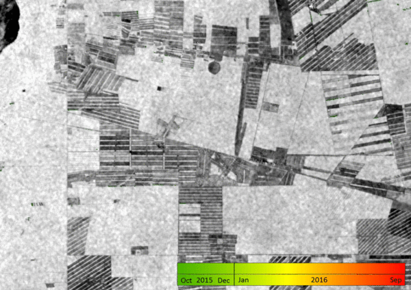 Deforestation | 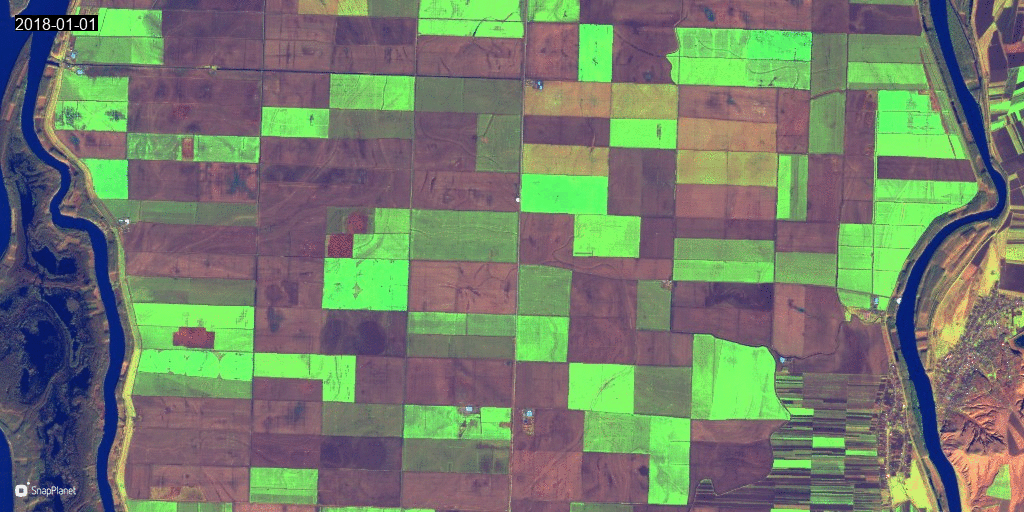 Agriculture |
|---|---|---|
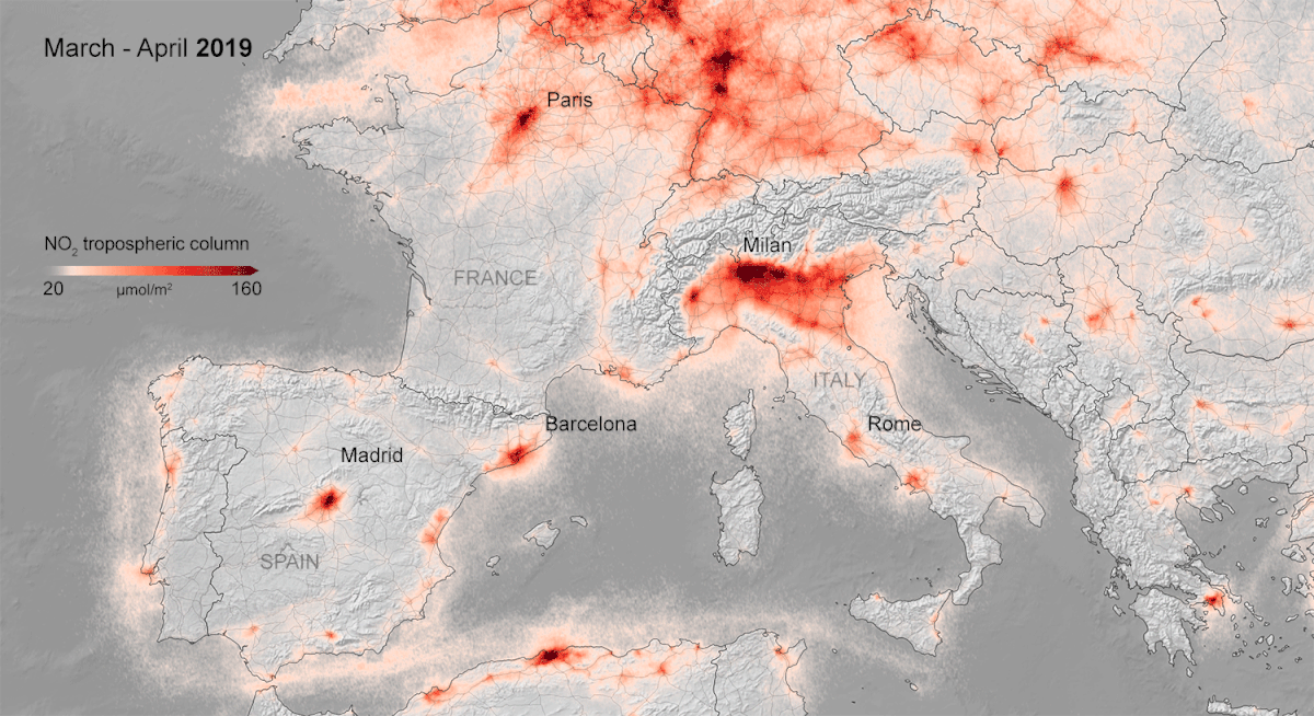 Air Quality |  evapotranspiration | 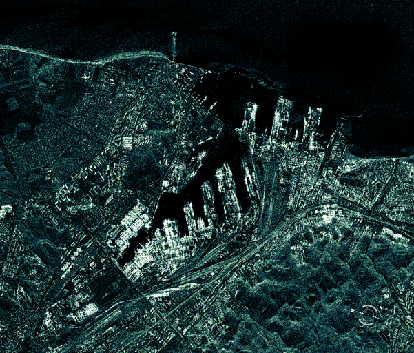 Maritime/Mobility |
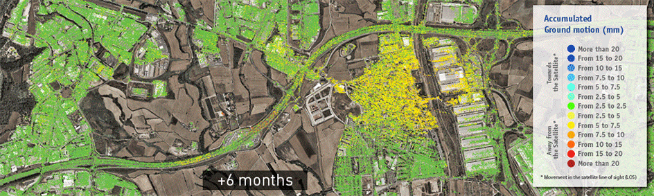 Change detection |  Agriculture |  Floodings |
 Volcanic Eruption |  Poverty vs. Pollution |  Faults |
 Mapping Trees | 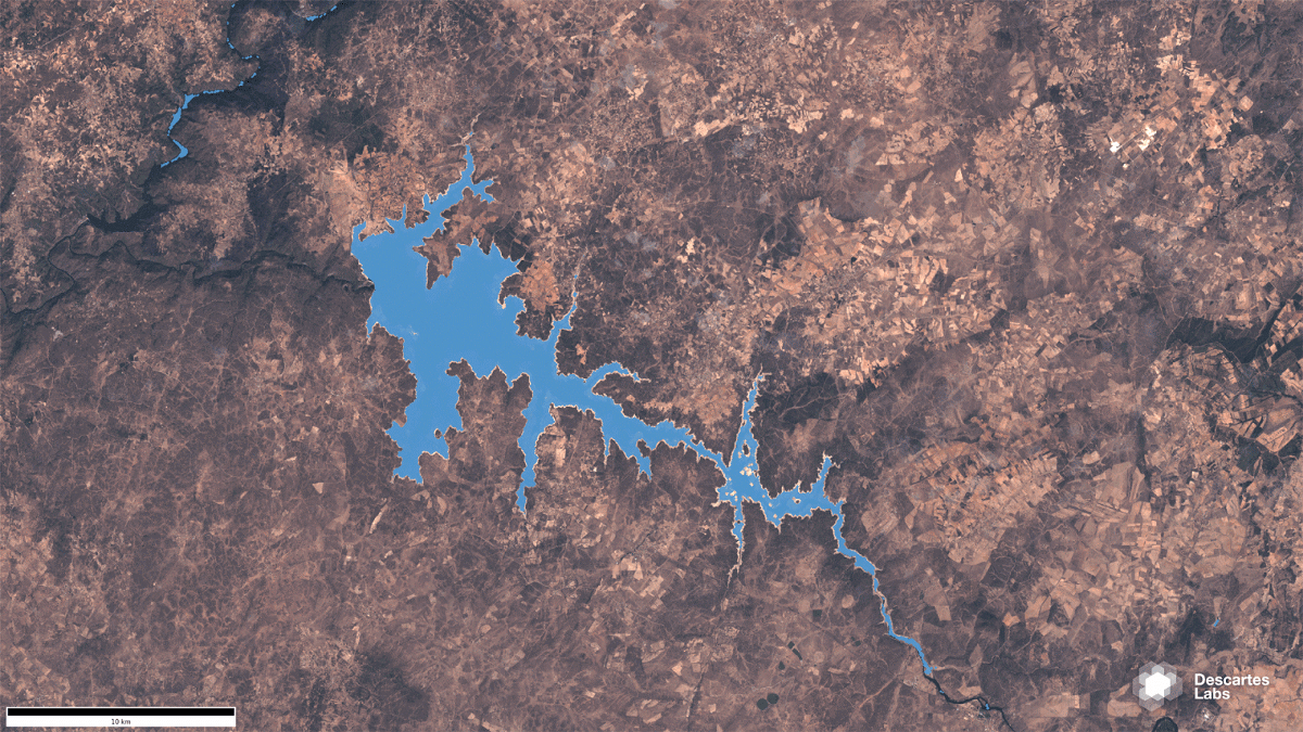 Water | 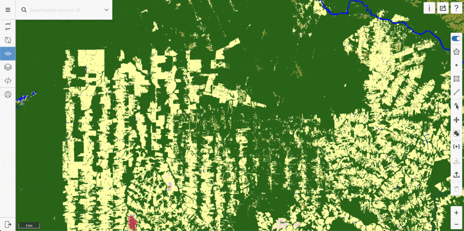 Change monitoring |
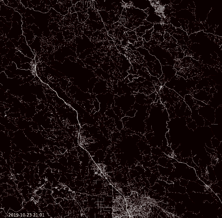 Fire | 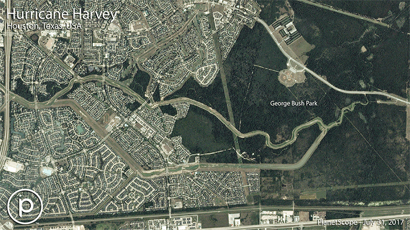 Weather Hurricanes |  Burning Man |
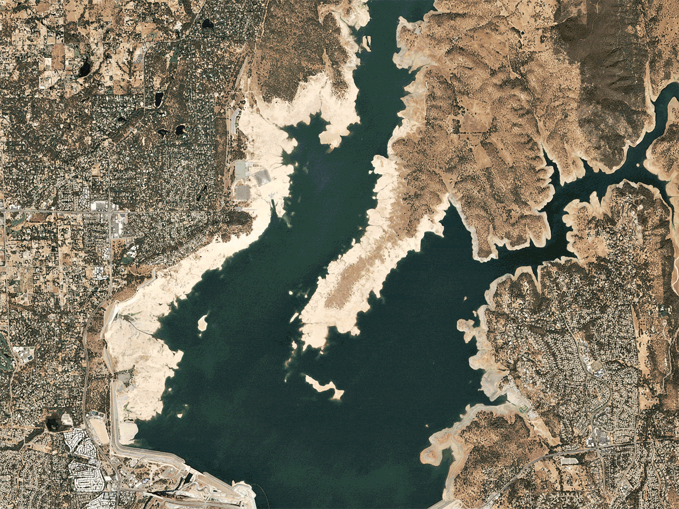 Flooding |  Flooding | 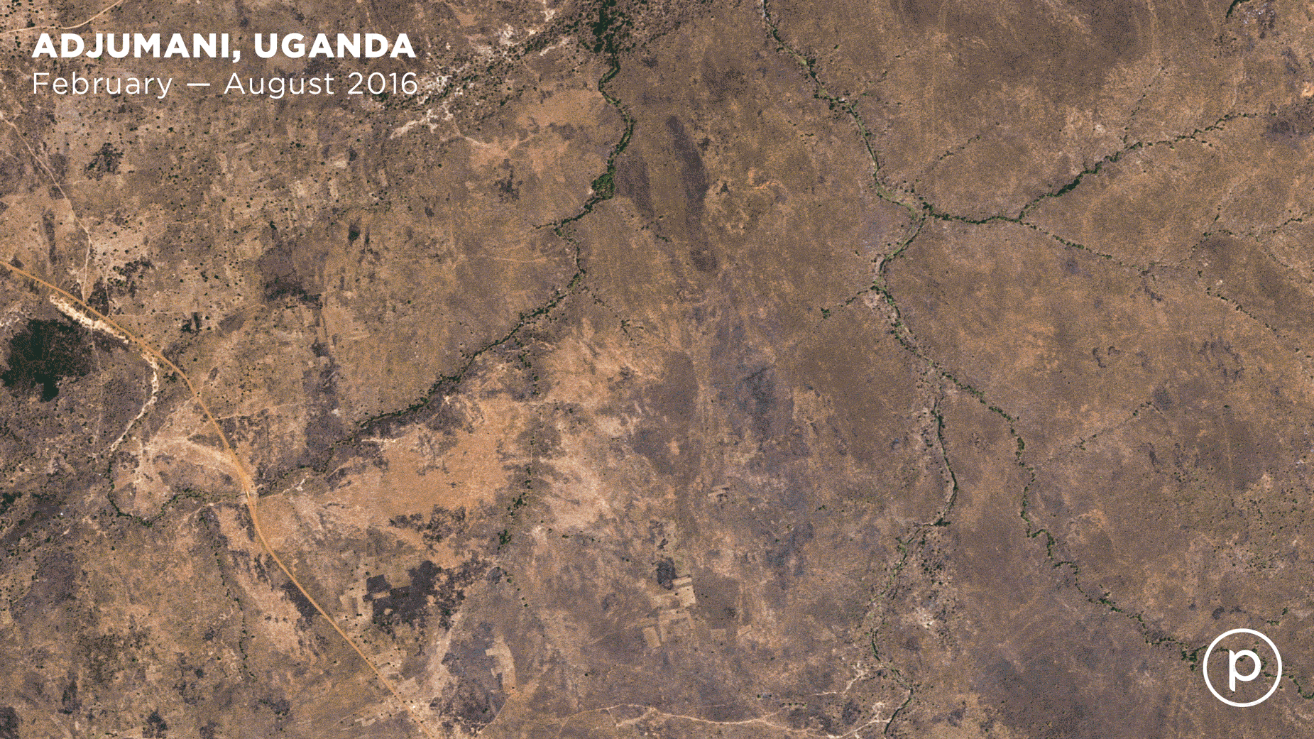 Refugees |
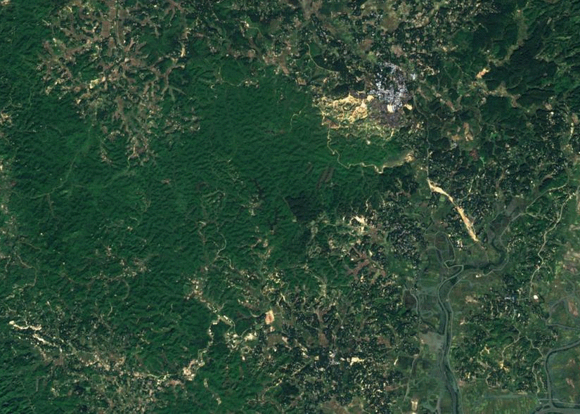 Refugees |  Deforestation |